Getting the transcript
Reading the captions from YouTube. A video nobody has opened here before takes 10 to 30 seconds; this page fills in on its own.
Getting the transcript
Reading the captions from YouTube. A video nobody has opened here before takes 10 to 30 seconds; this page fills in on its own.
Geography Effect · @GeographyEffect
Where viewers went back to watch this video again, from YouTube's public Most replayed graph, lined up with what was said at that moment.
Most replayed moment #1
6:506.9x the video's typical replay level
reliable infrastructure, and access to capital. Just as importantly, they happened to sit next to the largest consumer market in human history: the United States. Resources only create wealth if someone can extract them, transport them, finance them, and buy them. Canada happened to
Said at 6:43
Most replayed moment #2
5:046.0x the video's typical replay level
behind only Saudi Arabia and Venezuela. The geology didn't change at the border. Only the ownership did. And it wasn't just what was underground. Take British Columbia. The Columbia
Said at 5:00
Most replayed moment #3
7:383.9x the video's typical replay level
Canada is really two different geographies sharing one set of borders. The bureaucrats drew one country. The land drew something else. Which brings us back to where this story began. Go back
Said at 7:36
The graph counts replays. It does not show where viewers stopped watching.
Words
1,220
Runtime
8:53
Speaking pace
137wpm
Reading time
5min
137 words per minute, below the 160 25th percentile of 349 measured videos. That distribution comes from the 349-video hook study.
Opening (first 30 seconds)
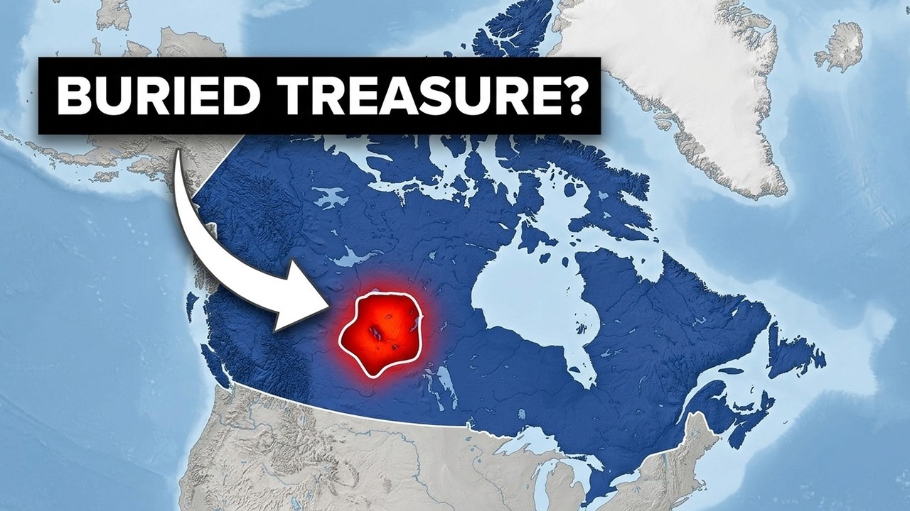
You’ve looked at a map of Canada and thought: big country. It's the second largest country on Earth. It stretches from the Atlantic to the Pacific. It looks complete. Like someone planned it. They didn't. The western half of Canada—everything from the Manitoba border to the Pacific—was divided by British officials sitting in London with a ruler and a handful of lines on a map. The borders don’t follow
69 words, the words spoken in the first 30 seconds at 137 words per minute.
Free, no signup. See how the first 30 seconds hold attention, with rewrites.
Sentence shape
| Measure | This transcript |
|---|---|
| Sentences | 123 |
| Average words per sentence | 9.9 |
| Longest sentence | 39 words |
| Questions asked | 3 |
| Sentences containing a number | 6 |
Most used terms
Filler phrases
5 in total: like 4 · actually 1.
A literal whole-word count of the same phrase list the Prepublish browser extension uses, so a phrase inside another word is not counted and a phrase used in its ordinary sense still is. It is a count and not a judgement.
What this transcript is
Every word below is the caption track YouTube publishes for this video, pulled from the video itself and reproduced unchanged. It is not Prepublish's writing, not a summary, and not a re-transcription: it is the video's own published captions. English captions, published by the channel, in the video’s original language. Source: the video on YouTube. A channel that would rather this page did not exist can ask for its removal through the contact page, and it is removed.
You’ve looked at a map of Canada and thought: big country. It's the second largest country on Earth. It stretches from the Atlantic to the Pacific. It looks complete. Like someone planned it. They didn't. The western half of Canada—everything from the Manitoba border to the Pacific—was divided by British officials sitting in London with a ruler and a handful of lines on a map. The borders don’t follow rivers or mountain ranges.
Just latitude and longitude. The strange part is that those lines ended up enclosing some of the most valuable geology on Earth. So how did a handful of bureaucrats, working from the other side of the Atlantic, accidentally draw borders around resources that now feed billions of people, power nuclear reactors around the world, and help supply the global energy market? Because that's exactly what happened. And the answer begins with the most ordinary-looking province in Canada.
The first place to look is Saskatchewan. On a map, it doesn't look remarkable. Just a giant rectangle in the middle of Canada. But it’s enormous. Overlay Saskatchewan on Europe and it covers Germany, Austria, Switzerland, and the Czech Republic—with room left over. And despite all that size, the landscape barely changes. Flat prairie stretches for hundreds of miles in every direction. And flat doesn't just describe what Saskatchewan looks like.
It explains how it formed. Hundreds of millions of years ago, this entire region sat beneath a shallow inland sea. Long enough for layer upon layer of sediment to accumulate across the bottom. Then the sea disappeared. What it left behind shaped Canada's economy long before there was a Canada. The first gift that sea left is obvious. Some of the most productive farmland in North America. The second is almost completely invisible.
Buried nearly a kilometer underground are mineral deposits unlike anything else on Earth. And that's where the story takes another turn. That buried gift is actually two different resources. One helps feed the world. The other helps power it. The first is potash. Beneath southern Saskatchewan sits the largest concentration of potash ever discovered—about 40% of the world's known reserves. Potash is the primary source of potassium in commercial fertilizer, one of the three nutrients modern agriculture depends on.
Remove it, and crop yields collapse. Think about what that means. Modern agriculture feeds more than eight billion people. It only works because farmers can continually replace the nutrients crops remove from the soil. Potash is how they replace one of the most important ones. If Saskatchewan were its own country, it would be one of the world's most strategically important agricultural suppliers—not because of what grows on its farms, but because of what's buried beneath them.
Germany produces about three million metric tons of potash each year. Saskatchewan produces more than twice that. From a province that most people drive through without a second thought. But fertilizer isn't the only thing hidden underground. The second resource is uranium. The Athabasca Basin covers much of northern Saskatchewan. It contains the highest-grade uranium deposits ever discovered. Mines like Cigar Lake and McArthur River contain ore that's roughly one hundred times richer than the global average.
That changes everything. Less rock has to be mined, and less material has to be processed. The same amount of fuel can be produced with a fraction of the effort. A single fuel pellet about the size of your fingertip contains roughly the same amount of energy as a ton of coal. Today, uranium from northern Saskatchewan powers reactors in France, South Korea, the United States, and the United Kingdom. One province. One ancient sea.
Two resources the modern world depends on. And Saskatchewan isn't the only place where this happened. Take Alberta. The 49th parallel—the line that separates Canada from the United States for most of its length—was agreed to by treaty in 1818. They weren't thinking about oil. The same geological formation that produces oil in Montana and North Dakota continues north across that line into Alberta. That's where it becomes the oil sands.
Today, Alberta holds roughly 165 billion barrels of recoverable oil—the world's third-largest proven oil reserve, behind only Saudi Arabia and Venezuela. The geology didn't change at the border. Only the ownership did. And it wasn't just what was underground. Take British Columbia. The Columbia River begins in the Rocky Mountain Trench in southeastern British Columbia before crossing into the United States. By the time it reaches the Pacific, it has generated more hydroelectric power than any other river system in North America.
Roughly 40% of the Pacific Northwest's electricity comes from Columbia River dams. The dams are American. The water begins in Canada. Saskatchewan. Alberta. British Columbia. Different resources. The same pattern. If resources made countries wealthy on their own, Canada shouldn't be unusual at all. So why is it? Natural resources don't automatically make countries wealthy. In fact, history is full of countries where they've done the opposite.
Nigeria has oil. The Democratic Republic of the Congo has cobalt, coltan, and gold. Venezuela has the world's largest proven oil reserves. None became prosperous because of those resources alone. Economists even have a name for this pattern: the resource curse. When governments can fund themselves through resource extraction instead of broad-based economic activity, they have less incentive to build the institutions that create long-term prosperity.
So why doesn't that describe Canada? Because Canada's advantage wasn't just the resources. It was everything around them. The resources happened to lie inside a politically stable country with strong institutions, reliable infrastructure, and access to capital. Just as importantly, they happened to sit next to the largest consumer market in human history: the United States. Resources only create wealth if someone can extract them, transport them, finance them, and buy them.
Canada happened to have all four. The contrast shows up on almost any map of the country. Nearly 90% of Canadians live within 100 miles of the U.S. border. But most of the country's resource wealth lies hundreds of miles farther north. There's even a place called Uranium City — built almost directly above the highest-grade uranium deposits ever found. Today it has roughly 70 residents. The most valuable geology on the planet, and it's essentially a ghost town.
Canada is really two different geographies sharing one set of borders. The bureaucrats drew one country. The land drew something else. Which brings us back to where this story began. Go back to that map of Canada. At first glance it looks complete. Like someone planned it. They didn't. Much of western Canada was divided long before anyone understood what lay beneath it. The people drawing those lines weren't trying to capture the world's largest potash reserves, or the richest uranium deposits ever found, or the third-largest proven oil reserve on Earth.
They couldn't have been. Most of those discoveries were still decades away. The lines just got there first. Canada isn't sitting on the most valuable land in human history because it made smart decisions. It's sitting on it because geology doesn't read maps. If you want to see how these same geographic principles might shape the next century, I made a video about four overlooked countries that could be far more important than they are today.
I'll link it here. The world has a structure. Let's keep finding it.
The words are the caption track's own and nothing is reworded or re-transcribed. Paragraph breaks are placed between sentences so the text reads as prose.
Free tools for your own script. No signup, no login.
Paste your draft and see where viewers are likely to drop off, with a rewrite for each weak line.
Paste the first 30 seconds of your own draft for a hook score and rewrites.
Check your draft against YouTube's advertiser-friendly guidelines before you record it.
Read this channel's public videos and transcripts, and download a writing brief for it.