Getting the transcript
Reading the captions from YouTube. A video nobody has opened here before takes 10 to 30 seconds; this page fills in on its own.
Getting the transcript
Reading the captions from YouTube. A video nobody has opened here before takes 10 to 30 seconds; this page fills in on its own.
The Silent Ruins · @officialTheSilentRuins
Words
5,056
Runtime
34:14
Speaking pace
148wpm
Reading time
21min
148 words per minute, below the 160 25th percentile of 349 measured videos. That distribution comes from the 349-video hook study.
Opening (first 30 seconds)
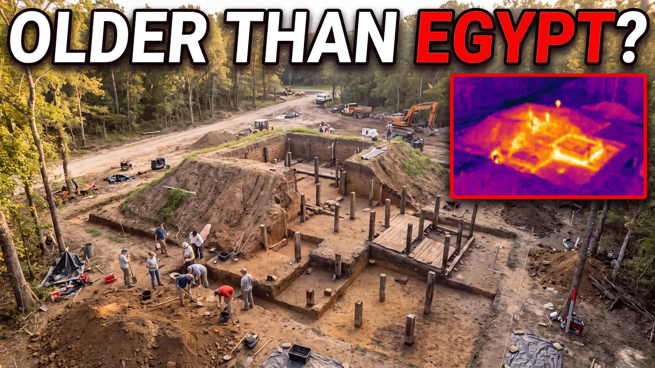
It rises from a stretch of pine forest above a slow brown river in northern Louisiana. 11 earthen mounds linked into a shape too deliberate to be a hill. Nobody thought to ask why it was there. Construction began roughly 5,500 years ago and continued for seven centuries. No wheels, no animals, no written records, only mobile hunter-gatherers stacking soil into a ring 900 ft wide. Its tallest mound >> [music] >> rising 25
74 words, the words spoken in the first 30 seconds at 148 words per minute.
Free, no signup. See how the first 30 seconds hold attention, with rewrites.
Sentence shape
| Measure | This transcript |
|---|---|
| Sentences | 307 |
| Average words per sentence | 16.5 |
| Longest sentence | 57 words |
| Questions asked | 8 |
| Sentences containing a number | 65 |
Most used terms
Filler phrases
38 in total: like 17 · kind of 13 · actually 8.
A literal whole-word count of the same phrase list the Prepublish browser extension uses, so a phrase inside another word is not counted and a phrase used in its ordinary sense still is. It is a count and not a judgement.
Run the check on the words above: where attention is likely to drop, with a rewrite for each weak line. The free check shows the scores and the one issue costing the most.
What this transcript is
Every word below is the caption track YouTube publishes for this video, pulled from the video itself and reproduced unchanged. It is not Prepublish's writing, not a summary, and not a re-transcription: it is the video's own published captions. English captions, generated automatically by YouTube, in the video’s original language. Source: the video on YouTube. A channel that would rather this page did not exist can ask for its removal through the contact page, and it is removed.
No Script X-ray for this video: YouTube shows a Most replayed graph only once a video has enough views.
It rises from a stretch of pine forest above a slow brown river in northern Louisiana. 11 earthen mounds linked into a shape too deliberate to be a hill. Nobody thought to ask why it was there. Construction began roughly 5,500 years ago and continued for seven centuries. No wheels, no animals, no written records, only mobile hunter-gatherers stacking soil into a ring 900 ft wide. Its tallest mound >> [music] >> rising 25 ft above the tree line.
A soil core driven into the tallest mound pulled up a layer of clay that takes thousands of years to form. Far older than the site's own paperwork claimed. Two laboratories using unrelated methods timestamped that dirt to the same impossible era. Every artifact beside it belonged to a culture not supposed to exist here for another 1,900 years. Strangest of all, after seven centuries across 11 mounds, [music] nobody has found a single grave.
For decades, archaeology's rule said monuments required farming, surplus, and a ruling class to organize labor. This site had none of that. Into the gap rushed talk of vanished advanced civilizations and outside contact. In 1993, a US Department of Agriculture soil scientist drove an auger into the largest mound. By 1997, radiocarbon [music] and luminescence dating from the University of Washington converged on one number.
The dirt was no longer a guess. That number would force archaeologists to rewrite the opening chapter of American prehistory. And it wasn't even the strangest thing buried in Louisiana. So, who were these people? And how did they pull it off? For most of the 20th century, the story of civilization had a fixed order. First came farming, then came surplus food, then came permanent villages, >> [music] >> then kings, then priests, then the labor to build something enormous enough to last 5,000 years.
That is how the pyramids happened. That is how Stonehenge happened. Archaeologists called it the Neolithic Revolution, a tidy staircase from wandering hunter to pharaoh. And for decades, almost nobody questioned the order of the steps. Monuments were supposed to be the reward for civilization, not the cause of it. You needed a bureaucracy to organize the labor, a religion to justify it, and a surplus of grain to feed the workers while they weren't out hunting dinner.
Without those three things, the theory said, you simply could not build on a monumental scale. It made sense. It fit everything else archaeologists had already found in Egypt, in Mesopotamia, in Britain. And then a set of dirt mounds in rural Louisiana refused to follow the rule. The site sits on a river terrace in Ouachita Parish, not far from the city of Monroe. 11 mounds connected by low ridges, forming a rough oval [music] about 900 ft across.
Nothing about it looks dramatic from the ground. No columns, no carvings, no gold. Just quiet rises in the soil covered in trees, the kind of thing a hiker could walk past without a second glance. For a long time, that's exactly what happened. The mounds [music] had actually been noticed decades earlier. In the early 1980s, >> [music] >> a local amateur archaeologist named Rebecca Bamberg Jones spotted the pattern after logging cleared part of the land, and she worked with a Harvard graduate student, John Belmont, to survey it in 1983.
But here's the first strange detail. When they filed it, they filed it the wrong era entirely. The site was classified as belonging to the Poverty Point culture, a late Archaic tradition from roughly 1700 to 1100 BCE. It sat quietly in that file for years. Nobody suspected it was actually thousands of years older than the culture it had been filed under. Jones wasn't a professional archaeologist. She was a local resident with a sharp eye and enough persistence to matter.
But a site survey is only as good as the assumptions behind it. And in 1983, there was no obvious reason to suspect these particular mounds were unusual. Louisiana already had a known mound-building tradition tied to Poverty Point. So, the new find got filed under that heading and set aside. It sat there, correctly located, but wrongly dated for the better part of a decade. Nobody was lying. Nobody was hiding anything.
That's what makes it such a dangerous kind of error. Not a cover-up, but a quiet assumption nobody thought to double-check. Sitting in a filing cabinet while the mounds kept a much older secret. That misclassification is where the real investigation begins. Because in the early 1990s, a Louisiana state archaeologist named Joe Saunders started taking a closer look. And something about the mounds >> [music] >> didn't sit right.
If this was a Poverty Point era site, it should behave like one. It didn't. Saunders brought in Thurman Allen, [music] a soil scientist with the US Department of Agriculture to auger into the largest mound in 1993. And that's the moment from the opening. Allen didn't just find dirt. He found a mature clay-enriched soil horizon buried deep inside the mound structure. The kind of layer [music] that forms only after a very long stretch of undisturbed time.
Soil doesn't lie about its own age the way pottery styles can be misread or wood can be misdated. It builds itself slowly, one mineral migration at a time. And the horizon inside that mound looked far, far older than 1700 BCE. That should have been enough to make archaeologists nervous. It was. Because at the time, the idea that hunter-gatherers with no farming, no ceramics, and no permanent settlements could have organized the labor to build 11 mounds sounded almost absurd.
The accepted model didn't allow for it. Some researchers were openly skeptical that mound construction was even possible during what's called the Archaic period, the long pre-agricultural stretch of North American prehistory. The theory required a chief. It required a surplus. It required exactly the kind of complex, hierarchical society that seasonally mobile foragers were not supposed [music] to have. So Saunders and his team did the only thing that could settle it.
They didn't argue, they tested. Between the early 1990s and 1997, the team pulled together an unusually thorough body of evidence. Radiocarbon dates from charcoal buried beneath the mounds. Independent luminescence dating from James Feathers at the University of Washington. A technique that measures when buried sediment last saw sunlight. Completely unconnected to the radiocarbon method. Stratigraphy. Diagnostic tools from the middle Archaic period.
Two separate dating techniques run by two separate labs with no reason to agree with each other unless they were both measuring something real. They agreed. In September 1997, Saunders and his colleagues published their findings in the journal Science, one of the most rigorously reviewed publications in the world. The mounds at what is now called Watson Brake were not built during the Poverty Point era at all. Construction had begun around 3,500 BCE and continued in stages for roughly 6 to 700 years.
That is not a rounding error. That is not a disputed guess. That is a mound complex built 1,900 years before Poverty Point existed and roughly 1,000 years before a single block was quarried for the Great Pyramid of Giza. Stonehenge's giant stone circle wasn't raised until around 2,500 BCE. Watson Brake was already old by then. Even the paperwork carries a small telling inconsistency. The original 1997 Science paper cites 27 radiocarbon dates.
The more detailed 2005 follow-up in American Antiquity lists 25 radiocarbon dates plus six luminescence [music] dates. Not a scandal, just science tightening its own numbers over time. But worth naming because this entire discovery rests on getting the count exactly right. Sit with that for a second because this is the detail that quietly rewrote a chapter of world history. The people who built Watson Brake had no crops, no permanent towns, no writing, no apparent king giving orders.
They were mobile foragers, moving with the seasons, eating fish, shellfish, deer, and wild native plants like goosefoot and marsh elder based on the midden evidence dug up around the site. And somehow, across centuries, generation after generation of these same seasonally moving people kept returning to this exact spot on the Ouachita River and kept adding to the same 11 mounds. According to researcher Rebecca Saunders, writing for the Louisiana Endowment for the Humanities, Many archaeologists before this discovery had been outright resistant to the idea that mounds could exist from the Archaic period at all.
The long-standing theory insisted that this kind of large-scale earthwork simply could not happen without a hierarchical society already in place to organize it. Watson Brake didn't just bend that rule. It broke it in public in a peer-reviewed journal with two independent dating methods backing it up. This wasn't an isolated embarrassment for archaeology, either. It fit into a much bigger reckoning. The old model, agriculture first, surplus second, hierarchy third, monuments as the reward at the very end, traces back to the Australian archaeologist V.
Gordon Childe and his idea of the Neolithic Revolution formulated in the 1930s. For most of the 20th century, it was treated less like a hypothesis and more like a law. Scholars including David Anderson and Kenneth Sassaman began pushing back on that rigidity even before Watson Brake's dates were confirmed. Arguing in the influential volume Signs of Power, edited by John Gibson and Philip [music] Carr, that Archaic period societies in the American Southeast deserved a serious second look.
Watson Brake gave that argument hard, dated, published proof. And it wasn't happening in isolation globally, either. Half a world away in Southeastern Turkey, a site called Göbekli Tepe, built by hunter-gatherers around 9600 BCE, more than 6,000 years before Watson Brake, was independently forcing archaeologists to the exact same uncomfortable conclusion. Monuments didn't have to follow farming. Sometimes, it now looked like farming followed the monuments.
And once the door was open, the next question became impossible to avoid. Why did they build it? Because here's where the trail runs cold and where the mystery becomes something closer to a locked room. No human remains have been confirmed at the site. >> [music] >> No burials. No obvious cache of prestige goods that would mark a chief's tomb the way you might expect from a hierarchical society flexing its power. What was the point of building something this large if not to bury a leader or store a treasure?
Some researchers, including Poverty Point specialist Diana Greenlee, have suggested these early mound-building events functioned as ways to reinforce relationships >> [music] >> and cooperation between scattered groups. A kind of built-in social glue gathering people together at fixed points in the year. Others have floated the idea of a territorial marker. A way of saying, "This land belongs to us without a single word being written down." Saunders himself once mused that maybe act of building was the actual purpose.
That the shared labor itself not the finished structure, was what held these communities together. Claims of deliberate astronomical alignment have circulated, too. But no widely accepted alignment has ever been confirmed. The honest answer is that nobody knows for certain. And that unanswered question sat there for years mostly unnoticed outside academic circles. While the real bombshell was still buried nearly 2,000 [music] years in Watson Brake's future.
Because if Watson Brake proved that hunter-gatherers could build monuments the next site in the story proved they could build monuments at a scale that should not have been physically possible without an economy nobody thought they had. Follow the Mississippi floodplains south and east from Watson Brake into West Carroll Parish near the small town of Epps and you arrive at a place called Poverty Point. If Watson Brake is the quiet, overlooked cousin, Poverty Point is the one that eventually got the recognition.
A UNESCO World Heritage Site as of June 22nd, 2014, >> [music] >> inscribed at a ceremony in Doha, Qatar. The 1,001st property ever added to that list. It had already been a National Historic Landmark since 1962 [music] and a National Monument since 1988. Walk the grounds today and you're standing inside [music] six concentric, C-shaped earthen ridges, stretching nearly 3/4 of a mile across, wrapped around a broad, open [music] plaza.
Five major mounds rise out of the landscape, the largest of them known as Mound A. It's roughly 72 ft tall, covering about 8 acres at its base, the second largest earthen mound in North America, after Monks Mound at Cahokia, built more than 2,000 years later. The scale of Poverty Point is where the numbers stop feeling like archaeology and start feeling like an engineering problem with no obvious engineers. Researchers estimate that roughly 750,000 cubic meters of earth were moved to build this site, close to a million cubic yards, with roughly as much soil again shifted just in site preparation.
Every scoop of it was carried by hand, no wheels, no draft animals, no metal tools. Archaeologist T. R. Kidder of Washington University in St. Louis has put it in blunt, modern terms. Conservatively, they moved 140,000 dump truck loads of dirt without a single wheel to help them. And they built it between roughly 1700 and 1100 BCE, centuries [music] after Watson Brake, but still without agriculture as the foundation of their economy.
These were still fisher-hunter gatherers. The accepted model didn't have room for this either. But the earthworks are only half the mystery. Because Poverty Point wasn't isolated. It was, by every measure archaeologists can find, a hub. Scattered across the site are millions of small, hand-molded, fired clay balls, known today as Poverty Point objects. Early researcher James Ford estimated a minimum of roughly 24 million of them, over 2,000 tons of fired clay.
Because the region has almost no natural stone, these objects were heated in fires >> [music] >> and buried in cooking pits, standing in for the hot rocks that other cultures used to slow cook food. That alone tells you something about ingenuity [music] born from scarcity. But the trade goods found at the site tell you something far stranger. Archaeologists have pulled copper from the Great Lakes region out of Poverty Point soil.
Soapstone >> [music] >> from as far away as the Appalachians in Alabama and Georgia. Chert from the Ohio and Tennessee River valleys. Quartz crystal and novaculite from Arkansas. >> [music] >> Marine shell from the Gulf Coast. More than 8,000 complete spear points have been recovered from the site. None of that material occurs naturally anywhere near West Carroll Parish. Every piece of it traveled hundreds of miles through hands, canoes, [music] and trade relationships that left no written record at all.
Picture a small green stone mined from an Appalachian hillside changing hands a dozen times across a network of rivers and footpaths until it finally gets buried in soil overlooking a Louisiana bayou. Nobody wrote down the deal that moved it. Nobody carved a receipt. The only record left is the stone itself, [music] sitting exactly where archaeologists trowels eventually found it, still carrying the chemical fingerprint of a quarry a thousand miles away.
So, picture what that actually requires. A society with no writing, no currency in the way we'd recognize it, no standing government, and apparently no permanent hierarchy, somehow running a trade network that stretched across a huge portion of what is now the Eastern United States, while simultaneously coordinating enough labor to reshape the landscape by hand. Kidder has framed the puzzle directly. The big question is why, not just how they physically did it, why anyone agreed to.
Cooperation on this scale usually comes with a cost, someone giving orders, someone benefiting more than everyone else. At Poverty Point, that someone is missing from the archaeological record. Small-scale societies elsewhere tend to struggle holding voluntary labor together without coercion or reward. Cooperation frays, people drift home. Poverty Point solved that problem anyway, at a scale that dwarfs almost anything comparable from the period, and the record doesn't say how.
That absence is exactly what set up the next test, the one that turned an impressive ruin into a genuine scientific reversal. For decades, the working theory was that mounds like these grew slowly, layer by layer, season by season, across generations, the same way a coral reef builds itself, grain by grain over centuries. A little added here, a little added there, no single moment of dramatic effort required. It was a comfortable theory.
It didn't demand you imagine thousands of people showing up at once with no chief to organize them. Then, in 2013, that comfortable theory ran directly into the evidence. Anthony Ortmann of Murray State University and T.R. Kidder of Washington University in St. Louis spent roughly [music] a decade excavating, coring, and analyzing the sediment inside Mound A, the largest structure at Poverty Point. They were looking for the telltale signs of gradual accretional construction, thin bands of weathering, soil development between layers, the kind of disconformity that rain and time leave behind when a mound sits exposed for years [music] before another layer gets added.
They published their results in the journal Geoarchaeology in 2013, and they found almost none of it. No erosion surfaces, no weathering bands, no soil development between construction stages. The sediment inside Mound A told a story of continuous, uninterrupted building, dirt piled on top of dirt on top of dirt, with essentially no gap in the process long enough for a single rainstorm to leave a mark. Do the math on that, and the implication is almost hard to say out loud.
Mound A required an estimated 238,000 cubic meters of soil. Kidder calculated it would take a modern 10-wheel dump truck about 31,217 trips >> [music] >> to move that much earth today. And the sediment evidence says it went up in less than 90 days, maybe as few as 30. Archaeology magazine reported the team's estimate that it took at least 3,000 laborers working in a coordinated bucket brigade fashion to pull it off in that window.
Kidder didn't hide his own astonishment. "It's truly amazing," he said, "that this ancient society could bring together a group of nearly 10,000 people, find some way to feed them, and get this mound built in a matter of months." Remember, these were people whose normal social unit, a forager band, typically numbered somewhere around 25 to 30 individuals. Multiply that by roughly 300, get them all in one place, all pointed at the same goal, all without permanent leadership as far as anyone can tell, and finish an 8-acre, 72-ft earthen mound before the season turned.
That is the reversal. Not simply that ancient people were capable of monumental architecture, but that they were capable of doing it at a speed that looks less like slow cultural evolution and more like a single, urgent, coordinated event. Which raises the obvious, uncomfortable question. What could possibly motivate thousands [music] of people with no king, no written law, and no long-term settlement to drop everything and build something this large, this fast?
Nobody has a confirmed answer. But the theories that have emerged say almost as much about the debate inside archaeology as they do about Poverty Point itself. For years, Jon Gibson, who wrote the foundational study, >> [music] >> The Ancient Mounds of Poverty Point: Place of Rings, argued the site functioned as something close to a real settlement, a substantial town and trading center, possibly even edging toward the kind of chiefdom that the old model demanded.
It made intuitive sense. A site this organized, this well-connected by trade, felt like it needed some form of centralized planning to hold together. But in 2025, a research team from Washington University, Kidder again, alongside Olivia Bald Gardol and Seth Groomes, published two papers in the journal Southeastern Archaeology that pushed back hard against that picture. Their argument, >> [music] >> Poverty Point wasn't a permanent town ruled by an emerging elite.
It was something closer to a massive, temporary gathering place >> [music] >> where dispersed hunter-gatherer groups converged periodically to trade, socialize, perform rituals, and then disperse again. They point to the absence of burials and the lack of evidence for long-term dwellings as support. Kidder has gone further, framing the construction itself as a kind of cooperative religious response to environmental instability.
Repeated flooding along the Mississippi system, describing the earthwork building, in his words, as an attempt to repair a torn universe. That reframing matters because it means the debate hasn't ended. It's evolved. The question of who built Poverty Point and why, and under what kind of social structure, is still an open argument between serious researchers using real excavation data published [music] in peer-reviewed journals as recently as this decade.
New lidar surveys of the site have added another wrinkle, showing that the ridges are less perfectly symmetrical than older idealized map suggested, meaning the layout may not have been fully planned from the very beginning, but adjusted and expanded as it grew. Every time archaeologists think they've settled the interpretation, the ground gives them one more reason to keep digging, and that unresolved space is exactly where a very different kind of story tried to move in.
Because sites like Poverty Point and mysteries like, [music] "How did people without agriculture build this?" are catnip for a certain kind of theory that [music] has nothing to do with peer review. In 2022, the Netflix series Ancient Apocalypse, [music] hosted by Graham Hancock, pointed to sites including Poverty Point and Ohio's Serpent Mound as supposed evidence of a lost, advanced, [music] global ice age civilization.
The implication being that simple hunter-gatherers couldn't have managed this on their own and must have received the knowledge from some vanished, more sophisticated source. It's a seductive idea. It [music] has the shape of a secret. But it is not supported by the archaeological record. And mainstream archaeology did not stay quiet about it. On November 30th, 2022, the Society for American Archaeology issued a formal open letter to Netflix stating plainly that after more than a century of professional investigation, there is no archaeological evidence to support the existence of an advanced global Ice Age civilization of the kind the series proposed.
The letter called the show's premise based on false claims about archaeologists and archaeology and recommended it be classified as science fiction rather than documentary. It isn't even a new argument. Scholars note it recycles claims popularized in by Ignatius Donnelly's writings on a sunken Atlantis, repackaged now with streaming documentary polish instead of a Victorian pamphlet. Here's what makes that rebuttal land harder than it might otherwise.
The fringe theory actually insults the real discovery. It assumes hunter-gatherers were too primitive to organize a project like Poverty Point on their own. The exact same assumption that the old Neolithic Revolution model made. The one that Watson and Brake had already shattered back in 1997. The truth that Saunders, Ortman, Kidder, and their colleagues actually dug up is more impressive than the myth, not less. Mobile foragers, with none of the tools civilization was supposed to require, organized labor on a scale that rivals early Old World monuments using nothing but cooperation, ritual, and whatever social glue kept thousands of strangers pointed [music] at the same pile of dirt for weeks at a time.
That's not a a that needs a lost civilization to explain it. It needs a serious rethink of what hunter-gatherers >> [music] >> were actually capable of. One that archaeology has been quietly building since a soil auger hit that clay layer in 1993. There's also a quieter, more human stake in getting this right. These earthworks were built by the direct ancestors of Native American communities who are still here, still connected to this [music] land, and who have watched outside theories get attached to their history again and again.
Theories that, whether intentionally or not, tend to erase [music] the actual builders from their own achievement. Crediting a vanished, imaginary, advanced civilization instead of the real indigenous societies who did the work isn't just bad archaeology. It quietly repeats an old and familiar erasure. The rigorous version of this story, the one built on radiocarbon labs and peer review instead of speculation, is also the version that gives credit where the evidence says it actually belongs.
The story doesn't [music] end in the lab, though. It moves into the much messier world of preservation, funding, and who gets to interpret the past. Poverty Point today is managed by the state of Louisiana as a state historic site in partnership with the National Park Service, open most days of the year with a visitor center, a small entrance fee, and tram tours across the ridges. Dr. Diana Greenlee, the site station archaeologist through the University of Louisiana at Monroe, has led research there since 2006 and was central to its 2014 UNESCO designation.
Under her watch, the science has kept moving. In 2022, non-invasive ground-penetrating radar surveys run with researcher Arnie Anderson Stamnes of the Norwegian University of Science and Technology, revealed something nobody had mapped before. A previously unknown buried ridge and what looks like an additional mound-like feature hidden beneath the site's central plaza. The layout everyone thought they understood is once again incomplete.
There is more of Poverty Point underground than there is above it and every new scan seems to find something the old maps missed. Stand in that plaza today and you're standing on top of an unopened page of the story, walked across by tourists who have no idea a hidden ridge is sitting a few feet beneath their shoes, glowing on a radar screen back in a lab, waiting for someone to decide it's worth digging into. That's not the only quiet threat the site faces.
A century and a half of plowing and farming flattened parts of the original ridges before the state ever protected the land. Erosion continues to wear at Mound A itself and researchers have used tree root dating, a technique called dendrogeomorphology, to track exactly how fast the mound's [music] surface is wearing away. A slow ongoing race between preservation science and time. Every layer that erodes is a layer of evidence gone before anyone gets to study it.
The mound that took perhaps 30 days to build is losing ground one storm at a time over centuries. And then there's Watson Brake, the site where all of this started, which never got Poverty Point spotlighted at all. It sits on private land today, a portion of it purchased by the Archaeological Conservancy in 1996 and eventually transferred into state ownership for protection. It is not open to the public. You cannot buy a ticket, walk the ridges or stand on top of Mound A.
The oldest securely dated mound complex in North America, the site that pushed the accepted date for organized monument building back by roughly 1900 years in a single peer-reviewed paper remains largely invisible. Tucked behind private property lines in Ouachita Parish, known mostly to specialists and to the archaeological literature that quietly rewrote the record in 1997. There's a strange kind of irony sitting inside that fact.
The site old enough to predate the pyramids by nearly 1,000 years gets no visitor center, no gift shop, no UNESCO plaque. It gets a locked gate and a line in a journal. Meanwhile, the pseudo-archaeology crowd searches for lost Atlantean engineers to explain monuments that real, named, peer-reviewed hunter-gatherers already built with their own hands, coordinated their own labor for, >> [music] >> and then in most cases walked away from without leaving a single written explanation behind.
That absence of explanation is really the last standing mystery here. Nobody has found a burial to confirm a chief at Watson Break. Nobody has found a permanent house to confirm a year-round town at Poverty Point. The people who organized 10,000 human beings to move nearly a quarter million cubic meters of earth >> [music] >> in under 3 months left behind clay balls, trade goods from 1,000 miles away, and quiet mounds in the woods, but not a name, not a title, not a single carved account of who was in charge.
Every dating method thrown at these sites has held up, radiocarbon luminescence, soil chemistry, sediment analysis. What remains stubbornly unresolved is the motive, and unlike the age of the mounds, that isn't a question a lab can answer with another test. Even the title of oldest isn't fully locked [music] down. Researchers have reported possible middle Archaic mound features at other Louisiana sites, Monte Sano near Baton Rouge, >> [music] >> Frenchman's Bend, and Hedgepeth, some potentially even older, though none dated with the same depth of independent evidence.
Watson Brake holds its title specifically as the oldest securely dated mound complex. If one of those other sites is ever nailed down with the same rigor, the record could shift again. That's not a weakness in the story. That's what a live, ongoing investigation looks like. So, the debate keeps going in real journals, between real researchers, in a way that should make you trust it more, not less. Gibson's [music] town, Kidder's temporary gathering place, Greenlee's newly discovered buried ridge sitting under the plaza right now, unexcavated, waiting for whatever comes next.
Every few years, another paper reopens the question that Watson Brake first cracked open in 1997. What were these people actually capable of? >> [music] >> And how badly did the old model underestimate them? Somewhere in Louisiana tonight, under a plaza that thousands of tourists have walked across without knowing it, a buried ridge that no one mapped until a radar survey caught its outline is still sitting exactly where it's been for more than 3,000 years. >> [music] >> Nobody has opened it yet.
And on a stretch of private land an hour and a half northwest, past a locked gate, 11 mounds that are older than the Great Pyramid keep standing in the trees, waiting on the next augur, the next test, the next crack in a story that [music] was supposed to have been finished 30 years ago.
The words are the caption track's own and nothing is reworded or re-transcribed. Paragraph breaks are placed between sentences so the text reads as prose.
Free tools for your own script: paste a draft and see where it stands before you record it.
Paste your draft and see where viewers are likely to drop off, with a rewrite for each weak line.
Paste the first 30 seconds of your own draft for a hook score and rewrites.
Check your draft against YouTube's advertiser-friendly guidelines before you record it.
Read this channel's public videos and transcripts, and download a writing brief for it.