Getting the transcript
Reading the captions from YouTube. A video nobody has opened here before takes 10 to 30 seconds; this page fills in on its own.
Getting the transcript
Reading the captions from YouTube. A video nobody has opened here before takes 10 to 30 seconds; this page fills in on its own.
Stefan Burns · @StefanBurns
Words
4,257
Runtime
28:34
Speaking pace
149wpm
Reading time
18min
149 words per minute, below the 160 25th percentile of 349 measured videos. That distribution comes from the 349-video hook study.
Opening (first 30 seconds)
Hey everyone, Gehysicist Stefon Burns here. Listen up. A very serious situation is currently unfolding across our entire planet that has direct implications for each and every single one of us and our livelihoods as a result of multiple climate instabilities which are rapidly accelerating in intensity and in impact. We're in the midst of a super El Nino that's about to hit its strongest phase because well the season of fall in the northern
75 words, the words spoken in the first 30 seconds at 149 words per minute.
Free, no signup. See how the first 30 seconds hold attention, with rewrites.
Sentence shape
| Measure | This transcript |
|---|---|
| Sentences | 282 |
| Average words per sentence | 15.1 |
| Longest sentence | 94 words |
| Questions asked | 6 |
| Sentences containing a number | 48 |
Most used terms
Filler phrases
90 in total: uh 44 · like 16 · basically 9 · um 9 · I mean 3 · actually 3 · right? 2 · sort of 2 · you know 2.
A literal whole-word count of the same phrase list the Prepublish browser extension uses, so a phrase inside another word is not counted and a phrase used in its ordinary sense still is. It is a count and not a judgement.
Run the check on the words above: where attention is likely to drop, with a rewrite for each weak line. The free check shows the scores and the one issue costing the most.
What this transcript is
Every word below is the caption track YouTube publishes for this video, pulled from the video itself and reproduced unchanged. It is not Prepublish's writing, not a summary, and not a re-transcription: it is the video's own published captions. English captions, generated automatically by YouTube, in the video’s original language. Source: the video on YouTube. A channel that would rather this page did not exist can ask for its removal through the contact page, and it is removed.
No Script X-ray for this video: YouTube shows a Most replayed graph only once a video has enough views.
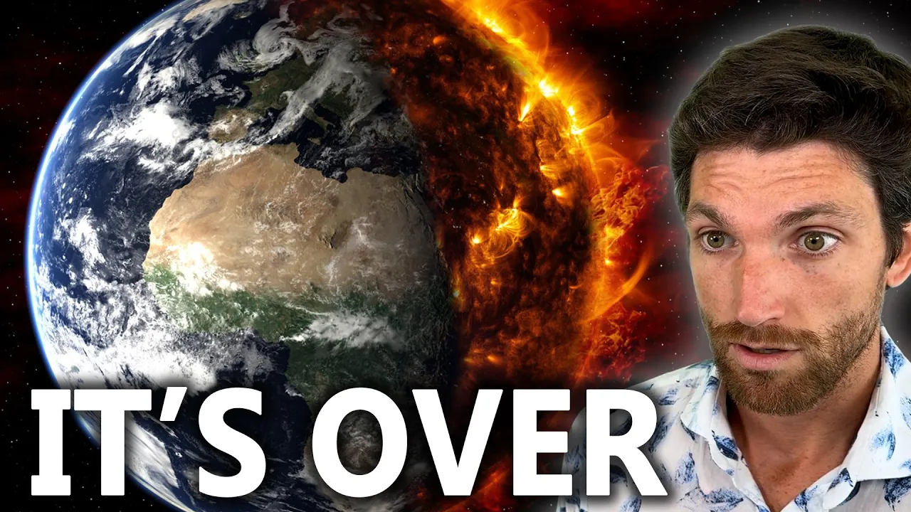
Hey everyone, Gehysicist Stefon Burns here. Listen up. A very serious situation is currently unfolding across our entire planet that has direct implications for each and every single one of us and our livelihoods as a result of multiple climate instabilities which are rapidly accelerating in intensity and in impact. We're in the midst of a super El Nino that's about to hit its strongest phase because well the season of fall in the northern hemisphere has begun.
That's when there's the strongest coupling between the ocean and the atmosphere. And the last time we had a super El Nino as strong, you have to look back to the 1870s and the 1770s. And the history of those two super elinos is not that bright and cheery. Now, these are different time periods, okay? We live in a totally different world, but the earth is still effectively the same. And she has a lot more control and power over us than most people realize.
There were huge famines and crop failures that happened during these super elinos. Many millions of people died. There was huge migrations and many other problems. So, as we go into the main phase of this super El Nino, expect the unexpected. We're already seeing the effects of this super Elnino and just in general of the instability of our climate as the planet continues to warm. So, we've had huge flooding in many parts of the world.
I mean, we're seeing non-stop flooding effectively hit Japan. We just had massive flooding strike Bangkok, Thailand. about 15 inches of rain fell overnight. This is 30 centimeters or so. Uh flooded most of the city. They've declared a huge disaster as a result of that. They're still dealing with that. There was of course that glacial collapse and that mud tsunami, that flash flood that struck Nepal back on the 26th of August.
Well, monsoon conditions have triggered a series of new major landslides in Nepal today. That is quite serious. There was this big nor easter that struck the east coast of the United States just a couple days ago on the 26th of September 25th and 26th that destroyed many coastlines. The beaches are just gone. Flooded many parts of the eastern seabboard, specifically New Jersey. Some of these coastal towns really got hit with big floods.
They're still dealing with that. We have category 3 Hurricane Polo here right now in the process of striking Baja California, Mexico. This is only originally forecast to hit Baja California at a category one status. Instead, it has stayed anomalously strong at a category 3 as it makes landfall. There's been huge surf and swell that has been created as a result of these cyclones in the Pacific. Hawaii has had three hurricane impacts this year, which is beyond crazy.
Typically, they get maybe one every 20 years or something. This year, they've had three now. We've had multiple category 5 monster hurricanes in the Pacific. And this El Nino is just getting started because October, November are typically the big months for El Nino. Meanwhile, in the Atlantic, there hasn't been a single hurricane yet this season, which is good news, but speaks to the severity of this super El Nino. So, we are going to be seeing changes to rainfall patterns around the entire globe.
This is not just concentrated to the Pacific or the Atlantic. We're talking about changes to Africa, the Middle East, Eurasia, the Americas. El Nino is a global phenomenon. And in October, November, we have the greatest coupling energetically between the ocean and the atmosphere. So in the spring, in the spring months for the northern hemisphere, that coupling is at its weakest. Now it's at its strongest. And well, there's a lot of energy in the oceans.
The oceans have absorbed by some estimates 90% of the excess energy that exists as a result of this energy imbalance. If you're unaware, there is this energy imbalance with the planet. So the outgoing longwave radiation is less than the incoming solar radiation. And this is because the atmosphere is able to hold on to more of this energy that is coming in as a result of changing atmospheric composition and dynamics. greenhouse gases, water vapor, CO2, others.
There's many other dynamics than just this. Also consider the fact that we had millions of years of sequestered sunlight in hydrocarbons and coal and other energetic substances that we've just suddenly basically lit up that releases that energy into our environment. Not all of it radiates away to space because of these atmospheric dynamics. So there's just simply more energy in the system now than there has been in a very very very long time and this is already affecting people around the world and it very well could affect you in the near future.
We hope everything is fine but just looking at things realistically looking at things personally as a geoccientist I'm a little worried about what is unfolding. So in this video we're going to discuss what is happening and some of the larger dynamics here because for example if you look at the spin rate of our planet how fast it spins on its axis the length of day that changes there are these decal changes which we track which are linked to uh alterations between torque electromagnetic and gravitational forces in the core of our planet.
So those alter the spin rate of our planet on decal time scales. We also see changes on daily and weekly time scales due to gravitational forces between the sun and the moon. We see changes with the spin rate of our planet on seasonal to yearly time scales based off of the uh state of the atmosphere. And so when you have a super elmu like this, you're having huge changes take place with the atmosphere. Now what's interesting is that we can look at these changes to the spin rate, the length of day for our planet and look at them in context of earthquake records and we see a very clear correlation suggesting that the overall spin of our planet has an influence on earthquake activity.
And that makes sense geohysically if you learn a little bit about it and think about it. Uh but what it means is that we could start seeing other geo events unfold as a result of what is happening perhaps atmospherically with this super elino in the months ahead. And I think already we're seeing that. That's my own personal assessment, but I recommend you do your own research. But there's a lot to cover in today's video.
So with that, let's jump right into it. The sun is the main driver of climate here on our planet. Most people are aware of the fact, of course, that we live in a Goldilock zone, a habitable zone around our star. If Earth was put significantly closer to the sun, it'd be unbearably hot. It would not be good. If we are further away, it' be unbelievably cold. So thankfully, due to our distance from the sun, we get just enough energy for it to be nice and pleasurable.
And most the energy the vast vast majority of energy that the earth has is due to the sun and the constant radiation of the sun of our planet. Now there are other forces and factors though with the sun. We just had a gigantic plasma filament launched from the sun today. We see these sort of filament eruptions every now and then. This one is quite large that is expected to impact us around the 2nd of October. It's not going to be a direct impact.
We see it occurred here off to the side. This is Earth's center and direct, but it is expected to impact us. The flank of this plasma storm is going to impact us around that time. That is the expectation that is likely to trigger increased geomagnetic volatility and this is an X factor as it relates to everything I discussed earlier on the super El Nino, weather patterns, the climate and more. As we get these solar events to bring more energy and plasma into our planet, they can dynamically perturb other systems and trigger chain reactions and it's like a domino effect.
So, this in of itself is not that big, but it is coming in. It's going to be expected to impact us right at the beginning of October when this super El Nino is really going to get started. In addition to that filament, we also have a large coronal hole here on the sun. This one being perfectly transquatorial. The geoeffected position for that is right about here, which means that it will be hitting us with a high-speed stream of solar wind.
There'll be a direct magnetic connection between the sun and earth when this guy is geoffective. And we see a connection between earthquake activity with coronal holes. We also see a connection to increases in vorticity in the atmosphere with coronal hole high-speed stream impacts. So that's like tornado activity, cyclone activity, and we've been seeing these cyclones in the Pacific. These hurricanes behave in ways that traditional weather models haven't been able to account for.
They've been staying stronger than expected. For for example, Hurricane Polo here, which uh is again impacting Baja right now. It went to category 5 status three different times. It went straight up to category 5, went down to four, five, four, five. Like, that's very, very bizarre. Some people would even classify this as a category six hurricane based off of wind speed. We don't have a category six, but if there was one, it would qualify.
So the second strongest ever cyclone in the Pacific that we know of with this super El Nino. So there is a tremendous amount that is happening. We can look at what's happening for the overall eastern Pacific here with our GOEZ imagery. So we'll hit play and we see these cyclones just rampaging across and new ones are forming because the sea surface temperatures are just so high right now. that there's a so much energy potential that the atmospheric systems can pull from the oceans that we're basically just going to get a non-stop stream of cyclones to move up across the western seabboard of North America over the next couple months.
Many of them, most of them will probably hit Mexico. Some will get flung out. We may even get some to go further north and impact California. This could be quite significant. We also have hurricanes in the uh the center of the Pacific. So we have hurricane Nolo which just sideswiped the Hawaiian islands. It came up from the south and then turned off there to the west. It has uh become a category 4 hurricane that was not on the forecast.
Another one of these examples of, you know, these hurricanes being stronger than forecasts by these traditional meteorology tools and models that they have. It's expected to get to category 5. Uh it did not directly impact like it moved over again. It went like this and then turned, but huge waves and surf and swell to the big island also to all the islands now. now that it's positioned offshore like this. And we also have uh a very strong tropical typhoon in the West Pacific now just off the coast of Japan.
So we can look at Surigay here and uh it is it was a category 5 super typhoon. Now it's just a regular typhoon. Uh but this was a very strong typhoon as we can see here and it is moving northwards like this off the coast of Japan. So tremendous amount of extreme weather right now in the Pacific while the Atlantic effectively has no activity just some tropical storms. There's been zero confirmed hurricanes for the Atlantic Ocean this entire season which is crazy yet to go back I think like more than 100 years now to to have that.
So this is really very very significant and uh this is likely to continue where we get a huge overabundance of cyclones in the Pacific and basically no activity here in the Atlantic. But we're going to be seeing changes across the entire globe as a result of this super Elnino. So where are the biggest impacts expected? If you look at our legend here, the darker the color, the more confidence there is in this overall forecast.
I'll link this post in the video description if you want to read this yourself. Zoom in, whatever. But we see it's effectively global. So, we see changes for North America, more drought up in Canada and warmer conditions, more rainfall there to the south, Mexico and parts of the United States. There we see lots of drought for South America. An inversion of that, heavy rain and floods expected September through February for Southeast South America.
Um, we see drought conditions effectively prevailing across Southeast Asia. big flood risk summer of uh because of this super El Nino that is expected and well we already know China gets massive floods like the biggest floods so that is not going to be good for China in 2027 uh weaker summer monsoon for north and central India meanwhile heavier monsoon for Sri Lanka the Horn of Africa here Ethiopia this region floods heavy short rains means uh for this fall October through December and then we are looking at uh flood risk and also crop risk uh failures for southern Africa here.
So basically across the board we are looking at pretty severe changes to normal weather and rainfall patterns. Uh droughts for some locations, super heavy rainfall and floods for others. And uh because it's out of phase, it's not really the normal expected weather rhythm can take people so by surprise and also have more uh devastating outcomes as a result. We we hope for the best, but we want to be prepared for the worst.
We see that this super El Nino is basically breaking records right here. This is our daily sea surface temperature for the 3.4 region. This is a Pacific location measured in the Pacific. So, they measure the sea surface temperatures there. Uh there's other locations that you can look at, too, but that's generally the most meaningful one. And we see 2026 here in red. You see some other big super Elnos too. Notice how they spike in basically October, November, right?
This one there, it spiked it looks like the 17th of November. We're already right at that level and it's not even October yet. So, this is expected to go even higher. We We'll find out what actually happens in October, November. It's expected to go even higher and then persist into 2027. So this is a comparison to 1982 to 2010 data or 1991 to 2020 data. So this is all our recent time frame that we're looking at here and it's just blowing everything else out of the water.
We can see these sea surface temperatures with our anomaly map right here provided by climate reanalyzer. uh huge overall sea surface temperature anomalies off the coast of South America on the equator. Also, there are very uh significant thermal isootherms at depth where the sea water is incredibly warm at depth in these locations. Also notice here the sea surface temperatures off Baja California and Southern California are greatly elevated.
So, this is going to allow these cyclones under the right conditions to basically travel right up and maybe make some historic impacts. That is possible. We're seeing this one right now with Polo strike Baja California. If this continues, we could see maybe even some hurricane impacts to Southern California this year. Uh that would not be good. We don't hope that happens, but it'd be good to be prepared for that. uh we are already seeing some really significant activity around the world.
So here we can see um what's happening in New Jersey. This is the noraster that struck on the 25th and 26th of September. Effectively people are arguing over like whether this is an extrropical cyclone. It has that spin to it. Um, but without getting into that conversation, this was a big storm, brought huge swell to the area, dumped a ton of water. Here we see footage from Beach Haven, New Jersey. Uh, so this entire town basically flooded.
Uh, this is really quite bad. Uh, as you can tell, and they are still feeling the impacts of this. If we look here, we see what happened to one beach in New Jersey as well. So here we have these sand dunes and they are completely insized by this nor easter and look at the homes right they originally had this sand dune and then the long beach to protect them not anymore. Now if a new storm comes in it could rip them out really really quickly which would be very very bad.
Uh we've just seen today some really really tragic uh sites from Nepal. Here we see an entire mountain collapsing in a landslide. We've been having monsoon conditions in Nepal as a result of heavy rain. There have been multiple landslides that have been triggered. Uh I mean this happens but it really seems to be accelerating as of late. We had that glacial collapse and then that massive uh flash flood. I call it a mud tsunami really. it's a better descriptive term for it.
Back in August, late August, this is about a month later, actually, almost almost exactly a month later afterwards. Um, and here is another view that we can see. Look at this entire house and the hillside just completely collapsing in this landslide in Nepal. Uh, it looks like they were ready for it to some degree. Uh and then they realized oh the rest of this slope could go so perhaps we should back up a little bit.
Um so we are getting these sort of really bad landslides to strike uh around the world not just Nepal but this is one location where it is more common because we're just seeing this acceleration of erosion and natural geological processes. When you have more rainfall coming in than normal, well, you're going to get more landslides and more erosion, and they are on the front edge of what's happening here on Earth. Also on the front edge would be many of these tiny Pacific islands that can't really accommodate much sea level rise.
Here we see footage from Thailand. This is Bangkok where they experienced massive flooding. Uh, I think they declared like a state of emergency across the entire city, all 50 districts as a result of the massive rainfall and flooding that occurred in Thailand. And we can see some more footage of that here. That hasn't stopped them from keeping their markets open though, which is interesting to see that they've continued to uh meet up and uh shop and everything even though they've had these pretty severe floods.
So, people are adapting, but the situation grows harder and more serious for many places day by day. Now, we've had some interesting earthquake activity just recently. So, let me show you that because this could impact quite a few people as well. Um, first and foremost is this magnitude 6.6 earthquake which struck near New Calonia. So, we see that right here. This is in the South Pacific off the eastern coast of Australia.
And we see the geology here very clearly. we have this part of the Australian plate subducting underneath this part of um the Pacific plate here. So, and you actually see that this entire structure is rotating and subducting. So, what was this earthquake? It was an extensional earthquake where the plate ripped apart like this. And look at all the aftershocks have occurred. A huge amount of aftershocks. Uh, I mean it's really spectacular and a little concerning because this is not a normal aftershock sequence.
We've had a magnitude 5.5. That's normal. But then you get a magnitude 5.4 and 5.3 and 5.3. Now it starts to become a little abnormal in just how strong the aftershocks have been and the number of them. Then we get all these other magnitude fives and this is still continuing to this day. uh this big magnitude 6.2.6 occurring on the 25th of September in universal time. So not that long ago, just a few days ago. Just today though, just today we saw a magnitude 5.4 earthquake strike Gac Ridge.
This is Earth's slowest spreading center. So it's a very interesting location. We don't know too much about the geology here because this is a fairly recent discovery. Uh but we see this 5.4 there north of Spalbard and the spreading rates here. This is oceanic crust that's being created. The spreading rates here are about 1 cm per year or 10 millimeters per year. Now if you go over here, we see this unusual depression in the oceanic crust and the spreading rates here are 6 millimeters per year or 6 centimeters per year.
So they're very very slow. For reference, if you go down to off the coast of South America, the southeast Pacific rise, the spreading rates here can be 15 centimeters per year. So why is there this imbalance in the spreading rates? Well, here you have a giant super volcano which exists which has uh basically created one of the largest volcanic eruptions ever in the the geological record that we know of. It's suspected that this caldera was blasted out 1.1 million years ago.
That would explain it. And if you're wondering the size of it, because maybe you're like, "Oh, well, I don't have a reference point." That's 31 miles across right there. And if we go the other direction, it is 63 64 miles across. So this is a massive um caldera from a volcanic eruption which was gigantic 1.1 million years ago and we saw activity not too long ago from Gac Ridge and this whole system here we can look at the historic activity.
So that magnitude 5.4 those these earthquakes on Galo Ridge do not occur every day. This is our record going back to 1990. All right. And we see, you know, a few a few dozen here, but on Galo Ridge itself, maybe two dozen earthquakes. You'll see a cluster here. So, we have this cluster of earthquakes right here. This was 1999. This is the strongest seismic swarm and burst to ever be observed on a mid ocean ridge in record.
And when they sent submersibles down to check it out, they found three new volcanoes. And they also found pyrolastic glass deposits. So this is a powerful enough eruption or eruptions to trigger pyrolastic flows under 34 kilometers of ocean water. The elevation here uh we're getting values of about 3.7 kilometers down. So the the pressure is immense. Even then these these eruptions are so strong triggered pyrolastic flows.
So, personally, when I see an earthquake strike Gawk Ridge, I pay attention. And while we just had an earthquake there today, and you I was talking about the the spin rate of our planet, how that's linked to the atmosphere, how it's linked to gravitational rhythms between the sun and the moon, how it's linked to changes with the core gravitationally, electromagnetically, and also as it relates to torque. Well, this is right near that spin axis.
So interesting synchronicity there. So there's a lot that's happening as you can tell and I really expect the super El Nino to become much more intense over the next few weeks and months and going all the way into 2027. I really don't think that in general we're ready for this. And if you look at what humanity is focused on, we are really not focused on what matters if you ask me. uh we're not focused on the people of this planet and their livelihoods and their good fortune and their health and their wellness, right?
And community building and more. Um but that's really a different conversation. But we are going to be seeing significant earth changes unfold as it relates to climate that's already happening, but as it relates to weather in the near term and perhaps as it relates to earthquake and volcanic activity. We've already seen really big earthquake activity and volcanic activity over the past couple years. The magnitude 8.8 earthquake which struck Kamaka, Russia last July 2025.
That was the strongest earthquake since 2011. And the volcanic eruption which struck Krakattow on September 5th was gigantic. We've had some really big volcanic eruptions over the past year. we could see that accelerate further and make everything that I've been talking about seem insignificant by comparison. So, that's the update for you. I will keep you up to date on everything that's happening with the Earth energetically.
If you subscribe to the channel, you'll see my videos. I release them almost daily. Thank you all so much for watching. I've been Yosfon Burns, wishing each and every single one of you well. Please take care of yourselves. I'll see you all in the next video.
The words are the caption track's own and nothing is reworded or re-transcribed. Paragraph breaks are placed between sentences so the text reads as prose.
Free tools for your own script: paste a draft and see where it stands before you record it.
Paste your draft and see where viewers are likely to drop off, with a rewrite for each weak line.
Paste the first 30 seconds of your own draft for a hook score and rewrites.
Check your draft against YouTube's advertiser-friendly guidelines before you record it.
Read this channel's public videos and transcripts, and download a writing brief for it.